![](/images/other/stat-length.png)
![Excursión Senderismo La Coucourde - alpion1 - Photo](https://media.geolcdn.com/t/1900/400/2c9b823b-5480-41f7-9cf0-b42ad1cd93ac.jpg&format=pjpeg&maxdim=2)
alpion1
parastat
Usuario
![Longitud](/images/other/stat-length.png)
Longitud
6,3 km
![Altitud máxima](https://static1.geolcdn.com/siteimages/upload/files/1508320355ic_sort_altitude_max_24dp.png)
Altitud máxima
388 m
![Desnivel positivo](https://static1.geolcdn.com/siteimages/upload/files/1508320355ic_sort_den_pos_24dp.png)
Desnivel positivo
241 m
![Km-Effort](/images/other/stat-length.png)
Km-Effort
9,5 km
![Altitud mínima](https://static1.geolcdn.com/siteimages/upload/files/1508320355ic_sort_altitude_min_24dp.png)
Altitud mínima
177 m
![Desnivel negativo](https://static1.geolcdn.com/siteimages/upload/files/1508320355ic_sort_den_neg_24dp.png)
Desnivel negativo
237 m
![Boucle](https://static1.geolcdn.com/siteimages/upload/files/16400158638029165_repeat_loop_refresh_sync_direction_icon.png)
Boucle
Sí
Fecha de creación :
2022-05-26 12:00:16.599
Última modificación :
2022-05-26 15:41:49.504
![Senderismo](https://static1.geolcdn.com/sitytour/trail-icons/101.png)
2h00
Dificultad : Medio
![Escanee este código QR para abrir la excursión en la aplicación SityTrail](https://capi.geolives.com/qq0zvz2zws4bq2lad0pu/sitytour/trails/3257757/qr.png?size=200)
Aplicación GPS de excursión GRATIS
A propósito
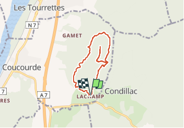
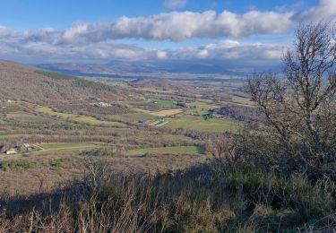
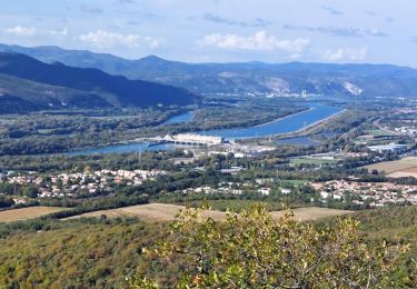
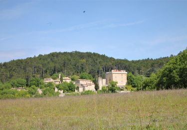
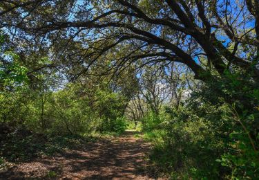
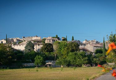
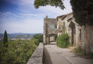
Ruta Senderismo de 6,3 km a descubrir en Auvergne-Rhône-Alpes, Drôme, La Coucourde. Esta ruta ha sido propuesta por parastat.
Descripción
IL est dommage de ne pas faire l'aller retour jusqu'au sommet, borne, point côté, pas beaucoup de vue mais le petit sentier est bien sympa.
Localización
País:
France
Región :
Auvergne-Rhône-Alpes
Departamento/provincia :
Drôme
Municipio :
La Coucourde
Localidad:
Unknown
Salida:(Dec)
Salida:(UTM)
643344 ; 4944662 (31T) N.
Comentarios
Excursiones cerca
![Excursión Senderismo Cruas - 07 cruas st Vincent de barres - Photo](https://media.geolcdn.com/t/375/260/b6e3219f-7af9-4a24-ac52-2d001f2a1138.jpg&format=jpg&maxdim=2)
![Senderismo Senderismo](https://static1.geolcdn.com/sitytour/trail-icons/101.png)
07 cruas st Vincent de barres
Senderismo
Medio
(1)
Cruas,
Auvergne-Rhône-Alpes,
Ardecha,
France
![](/images/other/stat-length.png)
14,9 km | 25 km-effort
4h 23min
![](https://static1.geolcdn.com/siteimages/upload/files/16400158638029165_repeat_loop_refresh_sync_direction_icon.png)
Sí
![Excursión Senderismo Sauzet - Sauzet Les Grands Abris 7km5 - Photo](https://media.geolcdn.com/t/375/260/dc904df7-2d15-4473-9afc-0180c6e306df.jpg&format=jpg&maxdim=2)
![Senderismo Senderismo](https://static1.geolcdn.com/sitytour/trail-icons/101.png)
Sauzet Les Grands Abris 7km5
Senderismo
Medio
(1)
Sauzet,
Auvergne-Rhône-Alpes,
Drôme,
France
![](/images/other/stat-length.png)
7,3 km | 11,7 km-effort
2h 26min
![](https://static1.geolcdn.com/siteimages/upload/files/16400158638029165_repeat_loop_refresh_sync_direction_icon.png)
Sí
![Excursión Senderismo Condillac - Condillac](https://media.geolcdn.com/t/375/260/3f6d13ae-e018-4efe-bd90-18499af23fce.jpg&format=jpg&maxdim=2)
![Senderismo Senderismo](https://static1.geolcdn.com/sitytour/trail-icons/101.png)
Condillac "Le Rocher de Ruas" 7km.
Senderismo
Medio
(1)
Condillac,
Auvergne-Rhône-Alpes,
Drôme,
France
![](/images/other/stat-length.png)
7,1 km | 11,6 km-effort
2h 38min
![](https://static1.geolcdn.com/siteimages/upload/files/16400158638029165_repeat_loop_refresh_sync_direction_icon.png)
Sí
![Excursión Senderismo La Coucourde - La Coucourde : Alpion et Tas de Pierre 6km - Photo](https://media.geolcdn.com/t/375/260/31960cbb-c19d-4c4a-8955-5c85ef0479f9.jpg&format=jpg&maxdim=2)
![Senderismo Senderismo](https://static1.geolcdn.com/sitytour/trail-icons/101.png)
La Coucourde : Alpion et Tas de Pierre 6km
Senderismo
Medio
La Coucourde,
Auvergne-Rhône-Alpes,
Drôme,
France
![](/images/other/stat-length.png)
6 km | 8,9 km-effort
2h 3min
![](https://static1.geolcdn.com/siteimages/upload/files/16400158638029165_repeat_loop_refresh_sync_direction_icon.png)
Sí
![Excursión Senderismo Condillac - 2022-09-27_13h26m12_14402804 - Photo](https://media.geolcdn.com/t/375/260/682fa6c2-f9ec-4b30-ade4-a125a2ae7aa0.jpg&format=jpg&maxdim=2)
![Senderismo Senderismo](https://static1.geolcdn.com/sitytour/trail-icons/101.png)
2022-09-27_13h26m12_14402804
Senderismo
Medio
Condillac,
Auvergne-Rhône-Alpes,
Drôme,
France
![](/images/other/stat-length.png)
10,6 km | 16,3 km-effort
3h 41min
![](https://static1.geolcdn.com/siteimages/upload/files/16400158638029165_repeat_loop_refresh_sync_direction_icon.png)
Sí
![Excursión Senderismo Saint-Marcel-lès-Sauzet - 2022-09-27_13h20m15_14402792 - Photo](https://media.geolcdn.com/t/375/260/9b95d8f7-96bf-4e7c-a753-aa87110b6003.jpeg&format=jpg&maxdim=2)
![Senderismo Senderismo](https://static1.geolcdn.com/sitytour/trail-icons/101.png)
2022-09-27_13h20m15_14402792
Senderismo
Fácil
Saint-Marcel-lès-Sauzet,
Auvergne-Rhône-Alpes,
Drôme,
France
![](/images/other/stat-length.png)
6,3 km | 9 km-effort
2h 1min
![](https://static1.geolcdn.com/siteimages/upload/files/16400158638029165_repeat_loop_refresh_sync_direction_icon.png)
Sí
![Excursión Senderismo Sauzet - 2022-09-27_13h19m12_14402793-2 - Photo](https://media.geolcdn.com/t/375/260/7a0f940a-b445-4320-8788-dc8b4c52f3c2.jpg&format=jpg&maxdim=2)
![Senderismo Senderismo](https://static1.geolcdn.com/sitytour/trail-icons/101.png)
2022-09-27_13h19m12_14402793-2
Senderismo
Medio
Sauzet,
Auvergne-Rhône-Alpes,
Drôme,
France
![](/images/other/stat-length.png)
7,3 km | 11,8 km-effort
2h 40min
![](https://static1.geolcdn.com/siteimages/upload/files/16400158638029165_repeat_loop_refresh_sync_direction_icon.png)
Sí
![Excursión Senderismo Savasse - 2022-09-26_14h15m29_13096793 - Photo](https://media.geolcdn.com/t/375/260/2b473090-d36a-43fd-b8eb-9c5f8eb23398.jpg&format=jpg&maxdim=2)
![Senderismo Senderismo](https://static1.geolcdn.com/sitytour/trail-icons/101.png)
2022-09-26_14h15m29_13096793
Senderismo
Medio
Savasse,
Auvergne-Rhône-Alpes,
Drôme,
France
![](/images/other/stat-length.png)
6,9 km | 10,4 km-effort
2h 21min
![](https://static1.geolcdn.com/siteimages/upload/files/16400158638029165_repeat_loop_refresh_sync_direction_icon.png)
Sí
![Excursión Motor Saulce-sur-Rhône - sortie 4x4 - Photo](https://media.geolcdn.com/t/375/260/ext.jpg?maxdim=2&url=https%3A%2F%2Fstatic1.geolcdn.com%2Fsiteimages%2Fupload%2Ffiles%2F15247431544x4.jpg)
![Motor Motor](https://static1.geolcdn.com/sitytour/trail-icons/400.png)
sortie 4x4
Motor
Difícil
(1)
Saulce-sur-Rhône,
Auvergne-Rhône-Alpes,
Drôme,
France
![](/images/other/stat-length.png)
94 km | 136 km-effort
10h 48min
![](https://static1.geolcdn.com/siteimages/upload/files/16400158638029165_repeat_loop_refresh_sync_direction_icon.png)
No